By Moisés Aylas OrtizRainfall along the northern coast of Peru could reach cumulative totals of up to 300 millimeters in a single day during the summer of 2027. Meanwhile, various regions in the southern highlands and other parts of the country may face a precipitation deficit, which could compromise water availability for agriculture and the replenishment of reservoirs.
This was stated by Nelson Quispe, a spokesperson for the National Service of Meteorology and Hydrology (Senamhi), while discussing the latest bulletin from the Multisectoral commission responsible for the national study of the El Niño phenomenon (ENFEN by its Spanish acronym).
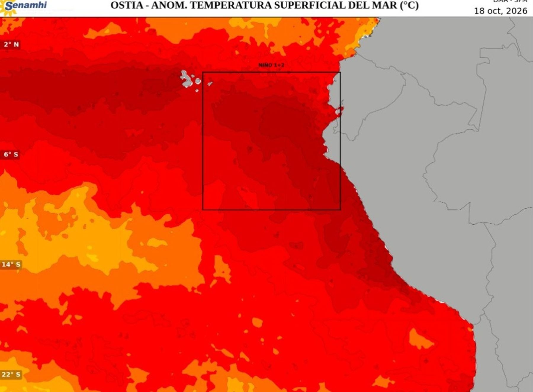
The bulletin outlines the progression of the 2026–2027 Coastal El Niño, noting that an "extraordinary" phase will continue until January of next year, followed by a "strong" phase that will persist into the autumn.
It should be noted that one millimeter (mm) of rainfall is equivalent to 1 liter of water per square meter.
In statements to the Andina news agency, Senamhi meteorologist Nelson Quispe explained that projections indicate sustained high sea-surface temperatures, with signs pointing to the arrival of new Kelvin waves—which carry warm water and could help prolong the event.
However, he clarified that the intensity of the rainfall does not depend solely on ocean temperatures, but also on the atmosphere's response.
“It is certain that it will rain,” he asserted, explaining that atmospheric conditions still need to be monitored to determine the total rainfall that might be recorded over the coming months.
The specialist noted that, while rainfall is expected to exceed typical levels, there is not yet enough certainty to establish the extent to which it might intensify. Consequently, projections will need to be updated as the behavior of the ocean and the atmosphere evolves.
Rainfall to intensify starting in November
Nelson Quispe indicated that significant rainfall episodes are expected to begin in November—initially occurring in specific, localized areas and interspersed with dry spells.
During September, some locations in Tumbes recorded up to 70 millimeters of rain, even though the typical accumulation for that month is only around 5 millimeters.
Quispe pointed out that, between this week and the end of October, further episodes with rainfall exceeding 30 to 40 millimeters could occur.
“These events would not necessarily happen every day; rather, they might be concentrated into one- or two-day periods, followed by days without rain,” he emphasized.
Regarding November, the Senamhi specialist stated that precipitation would begin to occur more frequently in Tumbes and Piura, with some episodes also affecting Lambayeque.
From December onward, this pattern is expected to become widespread across the northern coast; throughout January, February, and March, frequent and intense rainfall is anticipated in Tumbes, Piura, Lambayeque, and La Libertad.
Total rainfall could exceed levels recorded in 2017
One factor that has meteorological authorities on alert is the possibility that daily rainfall totals could surpass those recorded during previous El Niño events.
The specialist noted that in 2017, Piura experienced daily rainfall totals ranging from 200 to 240 millimeters. Looking ahead to the summer of 2027, he did not rule out the possibility that rainfall totals could exceed those figures—potentially reaching close to 300 millimeters in a single day—particularly in parts of Tumbes and Piura.
However, he emphasized that this is merely a potential scenario, and there is not yet enough certainty regarding the actual magnitude the rainfall might reach.
The distinction between above-normal rainfall and extreme rainfall lies in the total volume of accumulated water and its potential consequences.
Even rainfall that significantly exceeds a location’s typical levels can cause serious impacts, depending on the local terrain and its capacity to absorb or drain the water.
Temperatures could reach 40°C in the north
The warming trend is also expected to bring high temperatures to the Peruvian coast over the coming months. A specialist from Senamhi noted that temperatures near 40°C could be recorded along the northern coast—levels similar to those observed during the 2017 El Niño event.
Due to environmental conditions, the "feels-like" temperature (heat index) could reach between 42°C and 43°C.
In Lima—particularly in the eastern districts—temperatures could hover around 35°C, with a heat index nearing 38°C. Meanwhile, in Chimbote (in the Áncash region), maximum temperatures could reach between 33°C and 34°C.
The specialist explained that the coast will remain under warm conditions and that new temperature records could be set over the coming year.
Humidity, cloud cover, and wind will all influence temperature trends and the heat index. Clear skies allow for greater solar radiation, leading to rapid surface heating.
It was also noted that these high temperatures will not be limited to the coast. In parts of the Cusco region, at altitudes of around 3,000 meters above sea level, temperatures near 30°C have been recorded—a level the specialist described as unusually high for those locations.
Additionally, the specialist mentioned a reading of 41.4°C in a locality within the San Martín region, identifying it as a national record. This information was provided during the interview and would need to be verified against official records from the relevant meteorological station.
These warm conditions could persist until the autumn of 2027—roughly through May—before temperatures begin to gradually decline. "El Niño Costero" could extend into autumn
Regarding the evolution of the phenomenon, the specialist explained that warm conditions could persist throughout the autumn of 2027—a period roughly spanning April, May, and part of June.
He also noted that a drop in sea temperatures would not occur immediately, but rather gradually; therefore, warm conditions could persist for a significant portion of that season before transitioning to a phase of lower intensity.
“Monitoring oceanic and atmospheric conditions will be crucial for determining the intensity of rainfall and updating the scenarios projected for next summer,” the Senamhi specialist pointed out.
More from Andina:
(END) MAO / MDV
Publicado: 20/10/2026