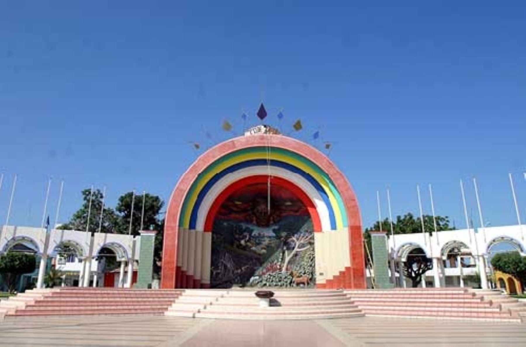
By Luis Zuta DávilaThe department of Tumbes celebrates the 205th anniversary of its declaration of independence today, January 7, with a special program of activities highlighting its history, identity, and regional pride. This anniversary is a magnificent opportunity to visit and enjoy its charming tourist attractions of this magic region of Peru.
History tells us that 205 years ago, the Tumbes council, led by its mayor José Jiménez; councilors Antonio Abad Puell, Juan Francisco Feijoó, Juan de Dios García, and Francisco Ibáñez; and secretary José Francisco Navarrete, read the act that proclaimed the region free and sovereign. They also expressed their allegiance to General José de San Martín.
Currently, Tumbes is the northernmost department on the Peruvian coast, bordering Ecuador, and is located 1,256 kilometers north of Lima. It has the only navigable river on the Peruvian coast: the Tumbes River. It also has the Zarumilla River, which carries water only during the rainy season.
Celebration activities
The program of activities celebrating the 205th anniversary of Tumbes includes a serenade held yesterday, January 6, in the Plaza de Armas (main square) of Tumbes, starting at 7:00 p.m.
On January 7, the main day of the anniversary, the official activities will begin at 8:00 a.m. with a Te Deum Mass in the San Nicolás de Tolentino Cathedral. An hour later, the ceremony of raising the national flag will take place, followed by a procession of the Tumbes flag.
Finally, a formal session will be held at 10:00 a.m. in the Javier Pérez de Cuéllar auditorium, with the presence of political, civil, military, and religious authorities.
Tourist attractions of Tumbes
The celebration of the 205th anniversary of Tumbes' independence is a magnificent opportunity to explore and enjoy the following emblematic tourist attractions of this charming region.
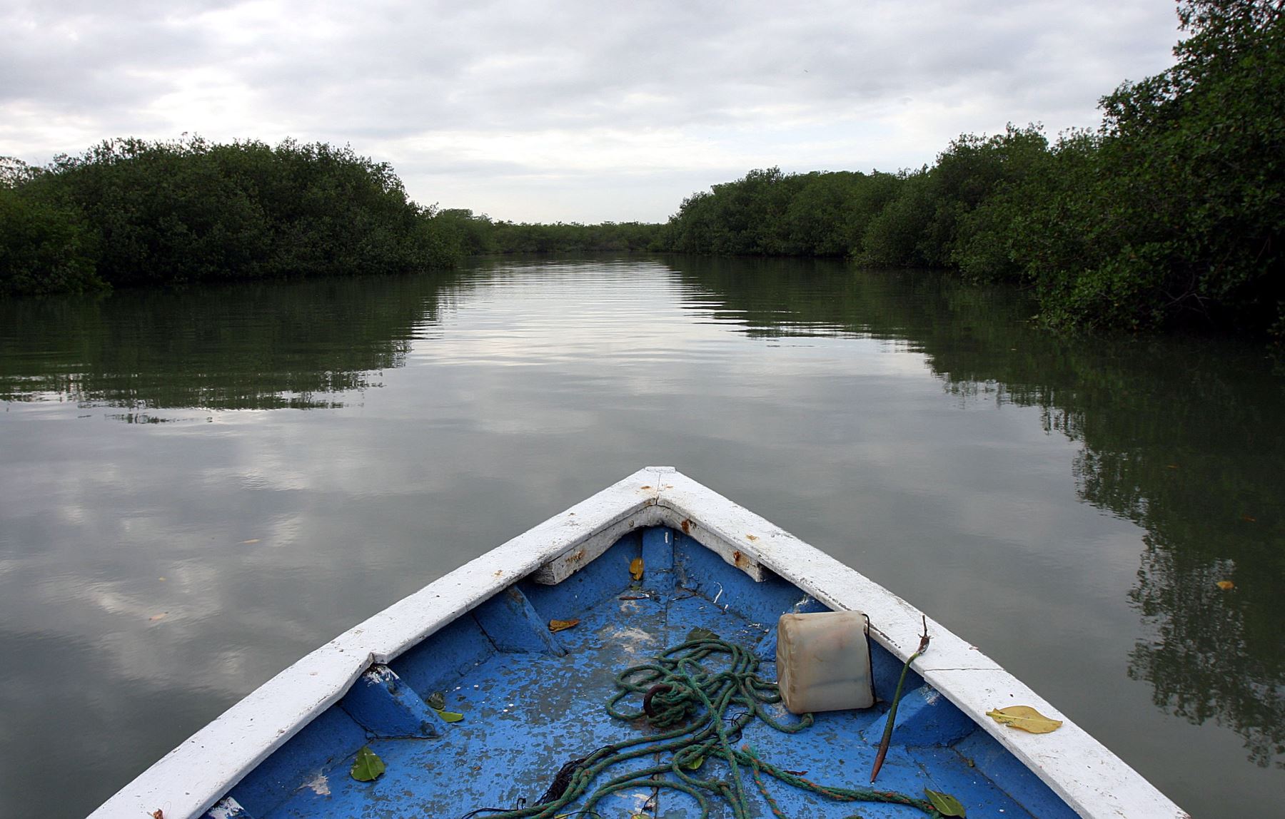
Los Manglares de Tumbes National Sanctuary
Established on March 2, 1988, this natural area protected by the State covers an area of 2,972 hectares and is located on the northern coast of Peru, in the district and province of Zarumilla.
It is a unique place because it is home to the largest expanse of mangroves in the country. Mangroves are a type of tree that grows in tropical areas where a river flows into the sea, thus nourished by both fresh and salt water from the ocean. In Tumbes, the mangrove forest extends from the delta formed by the mouth of the Tumbes River to Punta Capones, on the border with Ecuador.
Therefore, the value of this ecosystem lies not only in its biodiversity but also in the direct benefits many human communities derive from the harvesting, commercialization, and consumption of the aquatic products obtained there.
Mangroves are important areas for tourism, scientific research, public awareness campaigns, and environmental education.
The tourist and recreational area of the Los Manglares de Tumbes National Sanctuary encompasses the Zarumilla estuary, near the Camarones estuary, and continues along the Matapalo estuary to the La Envidia estuary, near the El Palmal sector.
This area covers 137.5 hectares (4.61% of the total area) and offers opportunities to explore the mangrove banks, navigate the canals by canoe and/or kayak, observe birds, and witness the harvesting of aquatic resources (experiential tourism).
The Interpretation Center, located at the El Algarrobo checkpoint in the buffer zone of the protected area, is a must-see.
The buffer zone also features a 60-meter-long pedestrian trail called El Oscuro, constructed through the heart of the mangrove using local materials, as well as two routes for exploring the area by small boats.
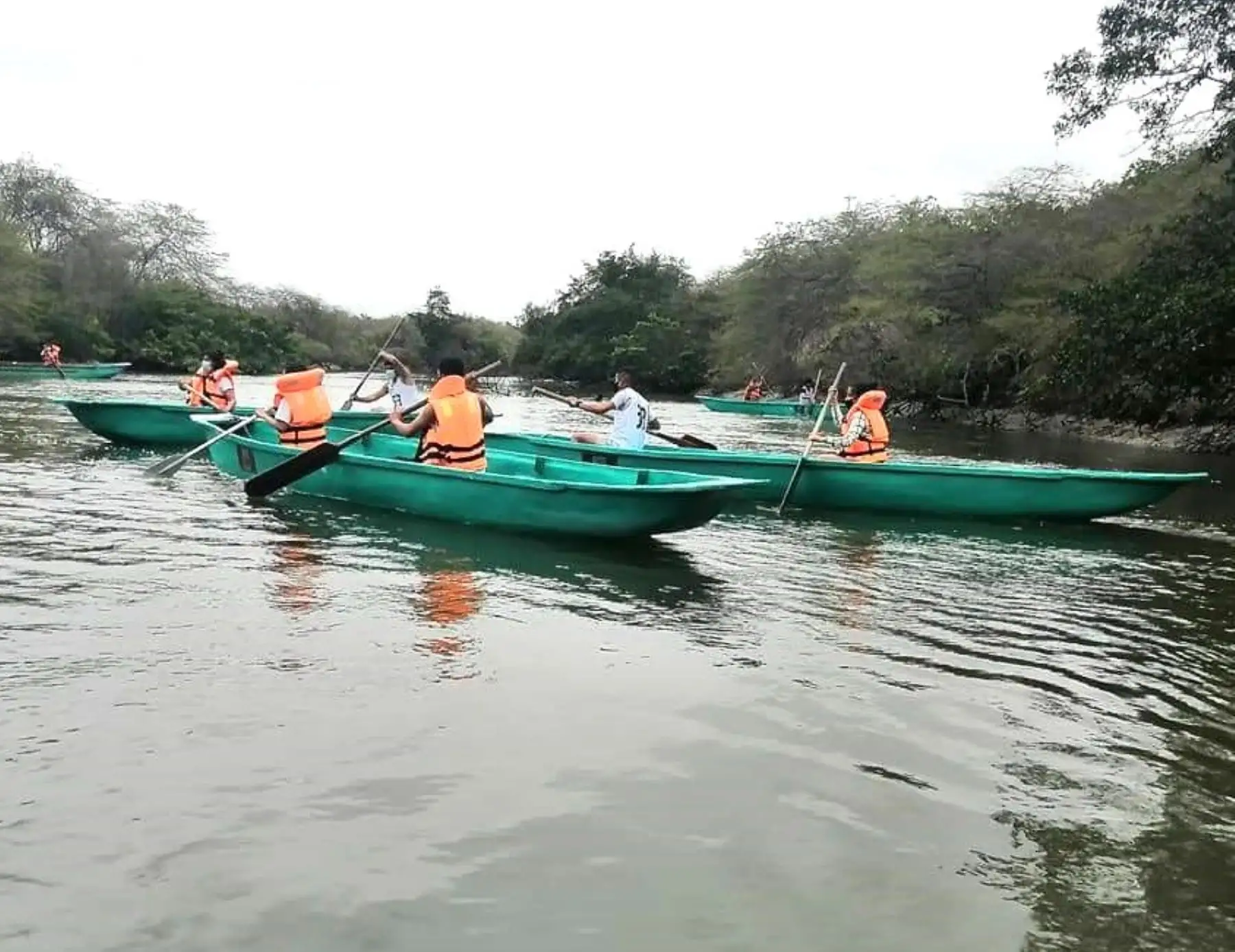
One of the circuits includes Puerto 25-Zarumilla Canal-El Toro Pool-Zarumilla Canal-Paracas Canal-Puerto 25. The other circuit consists of Puerto 25-Paracas Canal-Zarumilla Canal-Capones Point-Zarumilla Canal-Paracas Canal-Puerto 25.
You can also visit Puerto Pizarro, located 15 kilometers from Tumbes, which is the only artisanal fishing port within the mangrove forest in the country. It is also home to the Tumbes Crocodile Breeding Center, with approximately 350 crocodiles.
Cerros de Amotape National Park
Its diverse geography combines tropical dry forest with the hills of the northern Peruvian mountain range, also known as the Amotape Hills.
This natural area, protected by the State and established on July 22, 1975, boasts a rich biodiversity, including species such as the carob tree, the hualtaco tree, the charán tree, the sapote tree, the pasallo tree, and the guayacán tree.
The wildlife is varied and includes species representative of tropical forests, arid zones, and the Andes Mountains, such as the Andean condor, the ocelot, the red deer, the collared peccary, the northern anteater, the spectacled bear, the gray deer, the white-naped squirrel, and the red-headed parrot.
The ecological importance of Cerros de Amotape National Park has led to its inclusion in the Northwest Biosphere Reserve.
The park features hiking trails through hills and ravines, allowing for the observation of the flora and fauna of the equatorial dry forest. Visitors can also navigate the Tumbes River canyon. The park is open year-round.
Cabeza de Vaca Monumental Archaeological Zone
Located within the district of Corrales, in the San Pedro de los Incas sector, in the province of Tumbes, this Inca ceremonial center is possibly the most important in the area in terms of both discovery and historical significance.
While the area is attributed to Inca occupation, it may also have been a Chimú settlement. A prominent feature of this complex is a truncated pyramidal structure called the Huaca del Sol, which stands approximately 15 meters tall with a base measuring 100 by 250 meters.
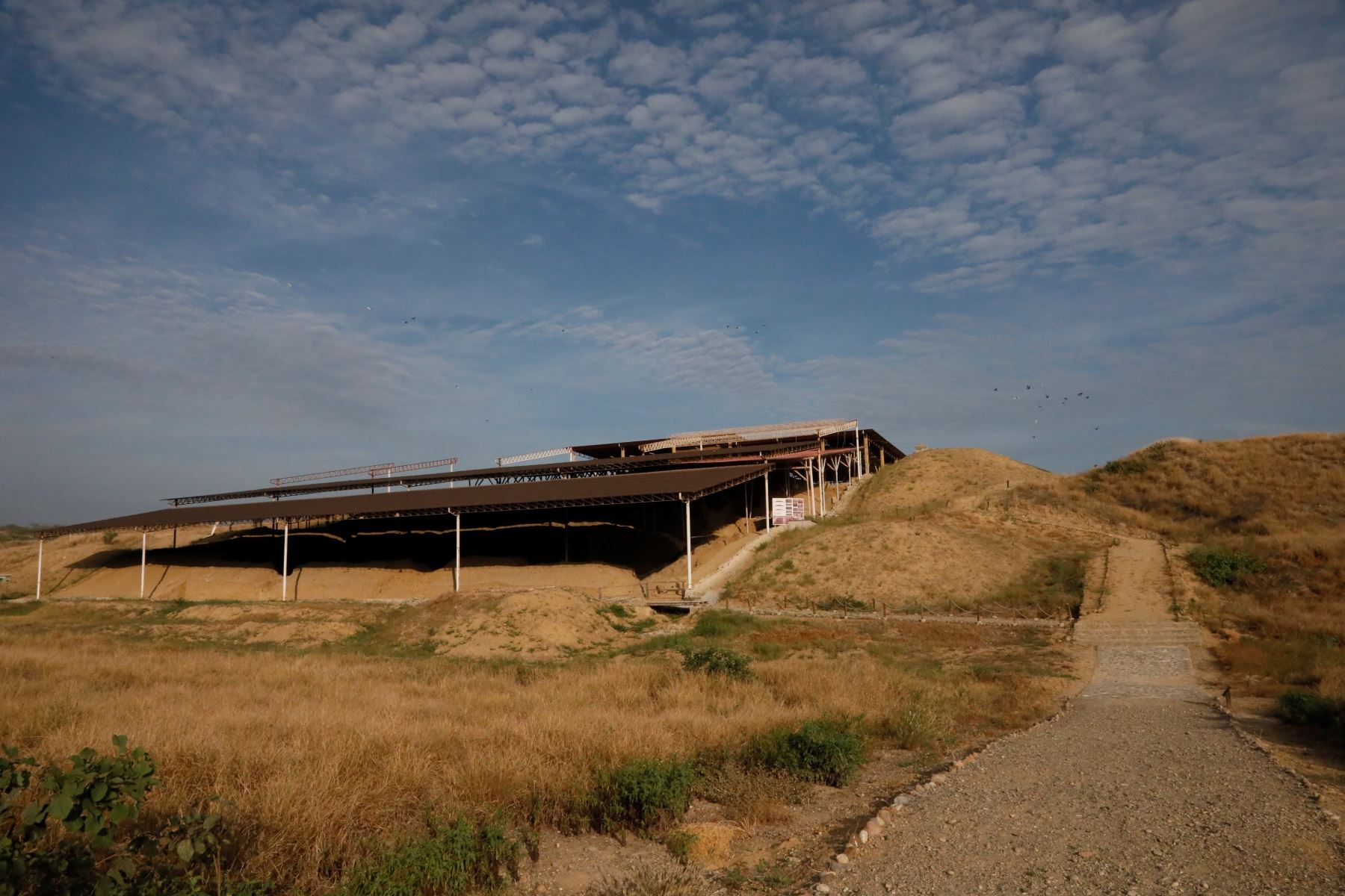
It has three superimposed terraces delimited by retaining walls made of adobe bricks to prevent erosion.
Structurally, the buildings in Cabeza de Vaca are made of adobe bricks, although stone is also used as another construction material.
"Hervideros" Hot Springs
This is an infrastructure built of stone and cement. It features three pools of hot spring water that appear to be constantly boiling and are associated with various medicinal properties.
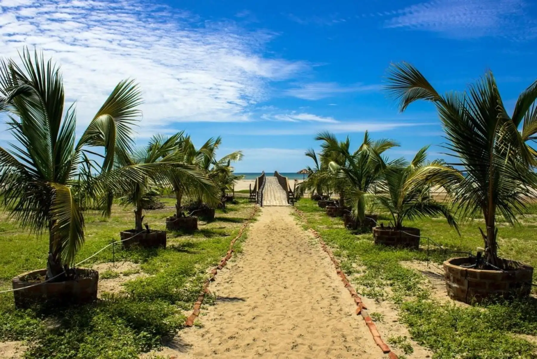
Punta Sal Beach
This is one of the longest beaches on the northern coast of Peru. It boasts fine, white sand and enjoys sunshine year-round with warm waters. It is an ideal setting for practicing sports such as surfing, diving, and sport fishing, among others.
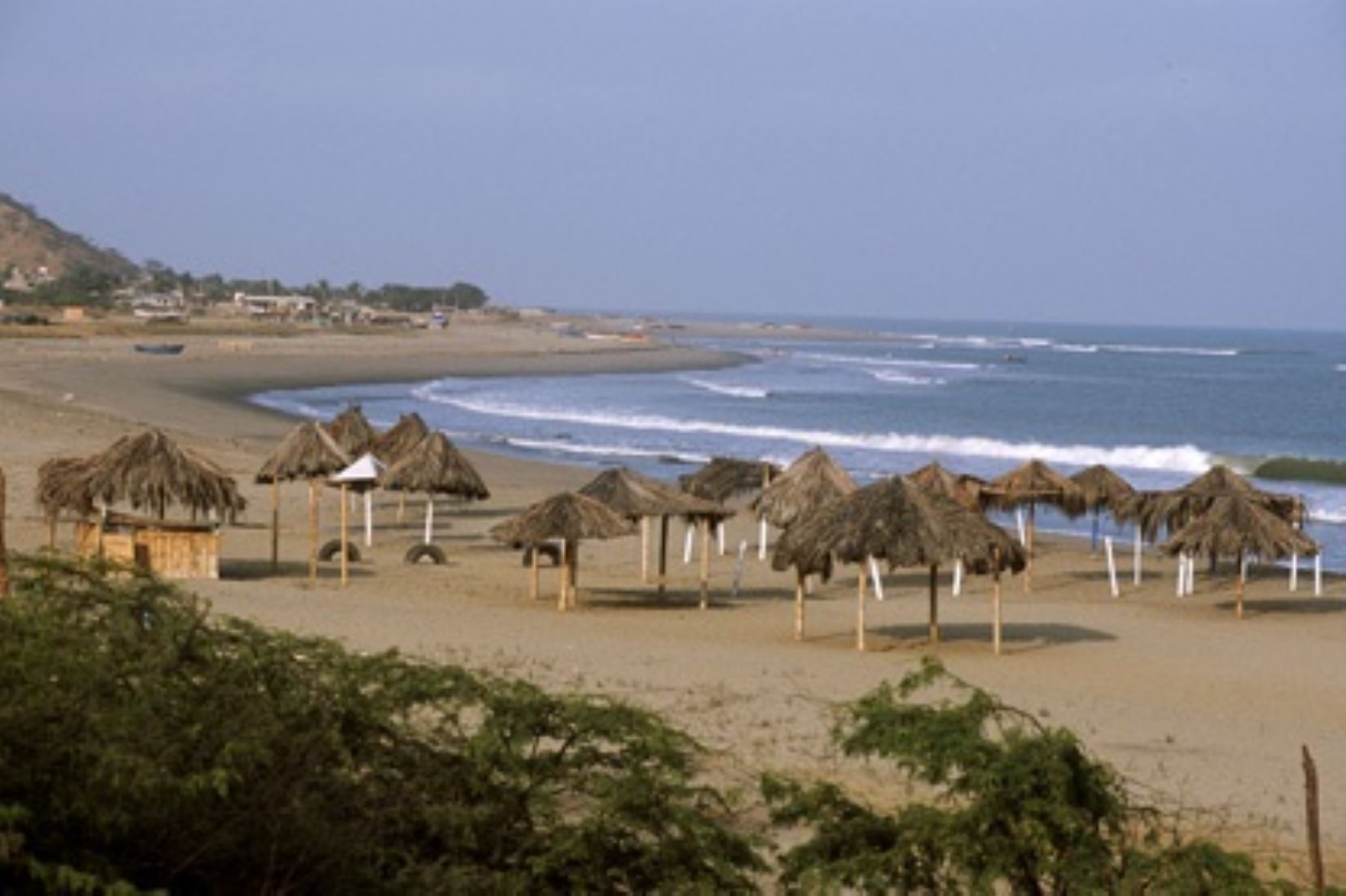
Zorritos Beach
This beach features warm waters and sunshine year-round, with light-colored, fine sand. It has ideal waves for water sports, making it a favorite beach among Peruvian vacationers.
Bocapán Beach
This slice of paradise is located just 27 kilometers south of the city of Tumbes and 8 kilometers from the Zorritos beach resort. It's the perfect place for a relaxing break and to recharge your batteries while enjoying its warm, calm sea that laps against a fine sandy shoreline.
Thanks to these attributes, its beachfront hotel offerings have increased in recent years, making it one of the largest and best on the northern coast of Peru, guaranteeing an unforgettable summer.
Cancas Beach
Located 75 kilometers south of the city of Tumbes, this horseshoe-shaped beach is known for offering opportunities to see sea turtles, dolphins, and whales, as well as local crafts and a variety of seafood.
Its pristine white sand, combined with warm, calm waters, makes this beach resort a paradisiacal haven, ideal for relaxing, recharging, and enjoying water sports and deep-sea fishing, activities that complement the opportunity to observe the aforementioned marine species.
More at Andina:
(END) LZD / MDV
Published: 1/7/2026