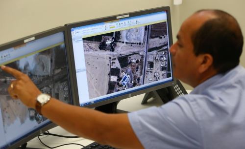
Imagery provided by PeruSAT-1, Peru's first Earth observation satellite, help local and regional governments to plan natural disaster prevention works and emergency relief efforts.
"These images, and the right program, allow us to build 3D models to observe the phenomena, streams and geography, as well as act accordingly," Defense Minister Jorge Nieto affirmed during a visit to Lima's National Satellite Imagery Operations Center (CNOIS).
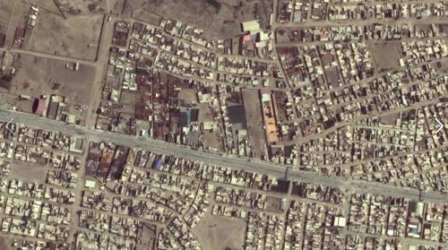
Such applications include the early detection of water accumulation in Santa Eulalia district (50.7 kilometers northeast of Lima Metropolitan Area) and consequent prevention of a landslide.
"Based on this information [satellite data], an Army battalion was deployed to relieve the water accumulated, thus preventing a serious problem," the minister explained.
In this sense, the Defense head invited regional governors to contact the National Commission for Aerospace Research and Development (CONIDA), Peru's space agency, to request the said material for emergency relief efforts.
"The [satellite] imagery service is free of charge, and we are willing to provide training when needed," he told reporters.
Likewise, work is underway to provide governors with direct access to PeruSAT-1 images and CONIDA's image records.
Nieto underlined it is fundamental that the three government levels carry out ongoing measures, since disaster prevention is a year-round endeavor.
"But there are times when we already know, as in the case of landslides, that we have to clean up rivers and streams," he stressed.
"And [urban] planning must be much more severe, so we don't have populations living in watercourses," he added.
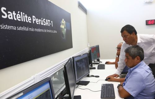
The minister was joined by CONIDA's Head Air Force Mayor General Carlos Caballero, who expressed the institution's full readiness to cooperate with local and regional governments.
(END) LZD/DHT/MVB