15:40 | Urubamba (Cusco region), Aug. 31.
The recent discovery of an Inca trail at the Mandor Wall in the Machu Picchu Archaeological Park, made possible by LiDAR technology, has surprised the world. Initial research in the area reveals that this route led to a sacred mountain used for ritual purposes in Inca culture.
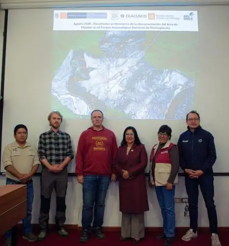
Specialists from the Decentralized Directorate of Culture (DDC) in Cusco and the University of Warsaw identified and revealed 2.5 kilometers of the ancestral trail, featuring Inca architectural patterns from the Late Horizon, using LiDAR remote-sensing equipment.
Initial studies in the area indicate that this Inca trail may have been used for ritual purposes because of its connection to Yanantin —a sacred space in the Andean worldview located at the highest point.
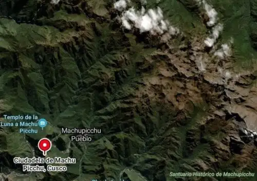
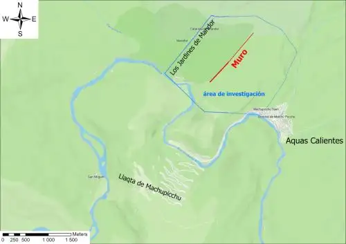
In this regard, Nino Del Solar, head of archaeological research at Machu Picchu, told Andina News Agency that Mandor is located east of the Inca Citadel of Machu Picchu.
The researcher explained that it is a wall with sections measuring 2 to 3 meters high, suggesting that it may have enclosed an area, even in the event of a military threat.
However, according to the specialist, "there is no archaeological context suggesting that there was a conflict in this sector that led to the construction of walls and the definition of areas," he clarified.
The specialist noted that the Inca trail was built based on the area's geographical structure.
"They are not the type of classic platforms that we can find in Machu Picchu, which have an orthogonal design; rather, they follow the same geography to which the Incas added architecture," he explained.
Heading toward Yanantin Mountain
Del Solar highlights that the trail's great value suggests that its use may have gone beyond this.
"This great wall makes us think that it was not actually a ‘wall,’ but a raised ritual path, because its direction goes toward a high peak that is precisely on the same axis as Yanantin. The line makes us think that it was a ritual path," he underscored.
Yanantin is located at 4,100 meters above sea level (masl).
It is a sacred mountain that was worshipped, as were the other mountains surrounding the Inca llaqta, such as Pumasillo, Machu Picchu, Putucusi, San Miguel, Wakay Willke, La Veronica, and Salkantay.
The latter was an Apu and a snow-capped mountain considered the protective entity of the vast area that comprises Machu Picchu.
According to the specialist, in the Andean worldview, it embodies a fundamental concept of balance, complementarity, and the duality of things in relation to the world.
Natural wall
"Whether or not there were conflicts is a complex and very interesting question. We know of conflicts that existed during the time of Inca Pachacuteq in the Ollantaytambo area; certain groups and societies generated some kind of disagreements, which ultimately led to some problems. As for a confrontation in the Machu Picchu area, it is very difficult because we do not have many historical texts, and Machu Picchu was left somewhat forgotten," Del Solar explained.
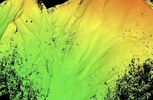
This Inca trail that crosses Mandor was surveyed by a drone, which collected very high-quality data with 3D models and revealed the stone network beneath the dense vegetation, as well as possible connections with archaeological sites.
"The application of LiDAR technology based on laser light not only confirms the existence of some circular enclosures, which were previously identified by Drs. Fernando Astete and Jose Bastante (former heads of the Archaeological Park), but also identifies new structures and platforms," he added.
In early 2027
The zigzag features observed, along with others yet to be discovered, including sections with platforms ranging from one and a half to two meters wide, will be physically revealed toward the end of this year and early next year through a project under Supreme Decree No. 011-2022 and its regulations.
An on-site physical survey will be conducted by the Ministry of Culture.
"What has been done is a non-invasive reconnaissance effort. This Mandor area is very particular because of its flora and fauna. The survey project is already being prepared with the idea of going directly to the identified trails, which have been properly geolocated," the expert said.
He noted that authorization from the National Service of Natural Areas Protected by the Peruvian State (Sernanp) is essential.
According to the specialist, the Inca llaqta of Machu Picchu is the core, the "heart," of a conquered space occupied during the Inca period, and the Inca trail demonstrates that the monument was not isolated.
Moreover, it reveals that it "forms part of an extensive network of more than 300 kilometers of trails connected to satellite sites."
"From the Mandor Wall, we have this 1.2-kilometer trail, which heads south and probably reaches archaeological enclosures identified previously," Del Solar added.
Finally, the researcher highlights the highly important work being carried out with interdisciplinary participation.
Experts from different international institutions (Poland, Japan, South Korea, and others) are conducting high-level activities that generate both local and international impact.

(END) PHS/MAO/MVB
Published: 8/31/2026